June 16th: Elevated Thunderstorm, Whitstable, Kent
After what seems like an eternity (nearly 3 years) we had another chance of a 'Spanish Plume' setup at night, so I had to have a go and try to capture some lightning.
Models were quite varied with the spatial extent of any storms, but as the far SE always had the better chance of something substantial, I headed for an initial spot at Bexhill-On-Sea in Sussex.
I arrived during a fairly weak storm, with heavy rain and a few CG lightning strikes. Unfortunately it was just too wet to get the camera out!
The radar indicated Kent was the place to be, so I headed to Romney Marsh, an area I've seen some great displays in recent years. I arrived as lightning frequency was really ramping up and was treated to a classic, elevated 'strobe' lightning display with near constant inter-cloud lightning (no CGs). Unfortunately no good for photography again!
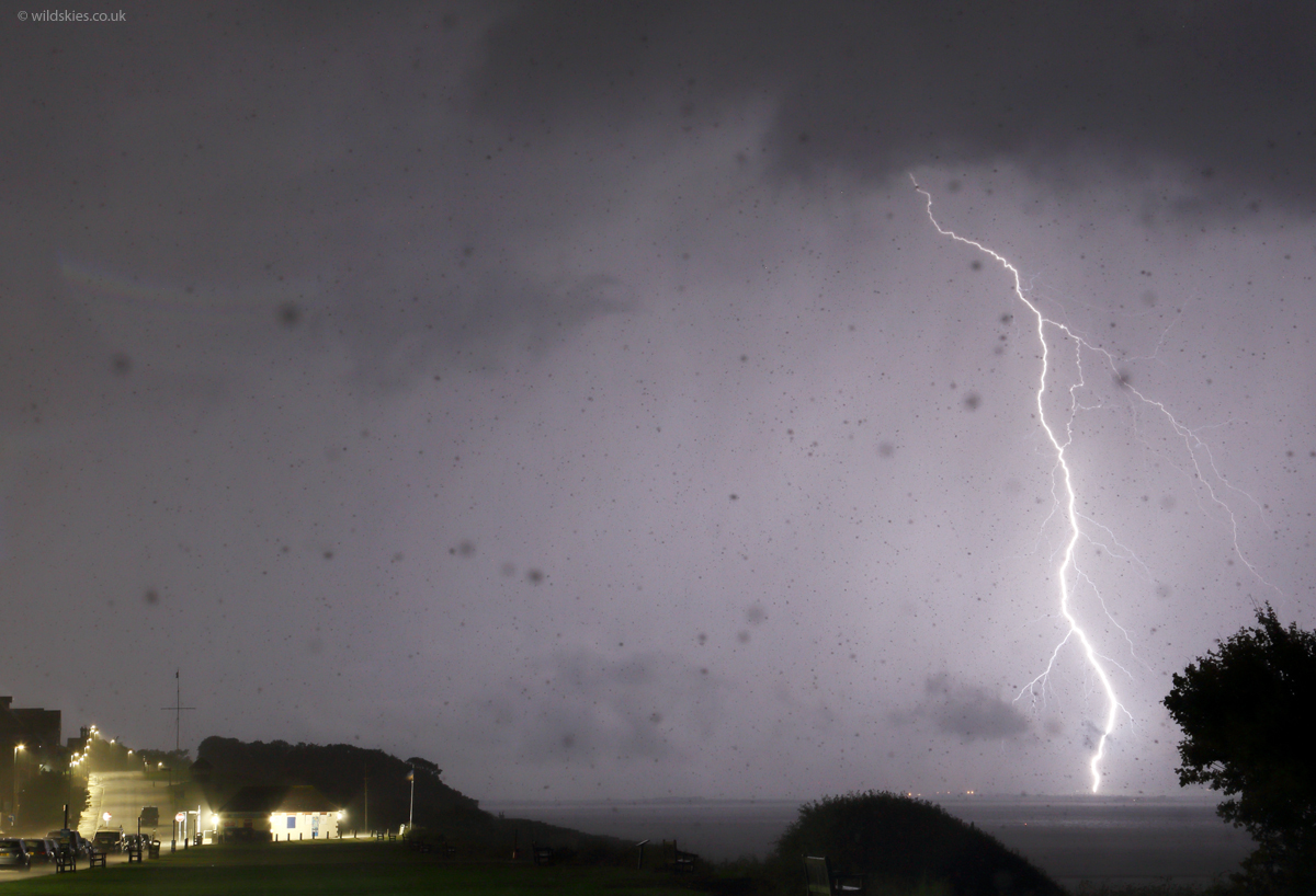
I decided to head to the north coast of Kent to see if I could get any lightning as the cells moved out over the Thames Estuary. The going was tough with copious flooding and debris-covered roads. Hythe was particularly bad, with a floating car seen on one road (no-one inside, parked). I arrived at Whitstable and set up my tripod just as a new cell fired up to my SW, finally producing some brilliant, clear CGs ahead of the rain:
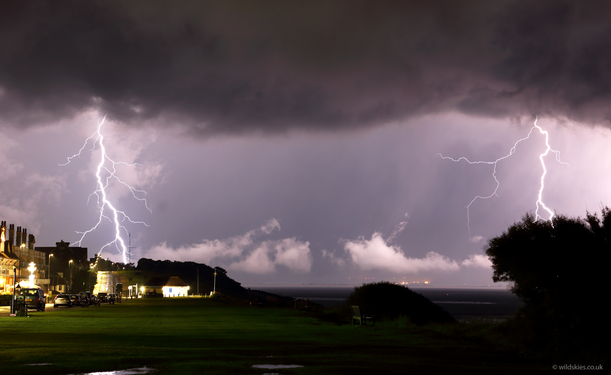
Annoyingly, some of the scenery got in the way of some of the bolts, but I couldn't be too picky with location as I needed a sheltered spot:
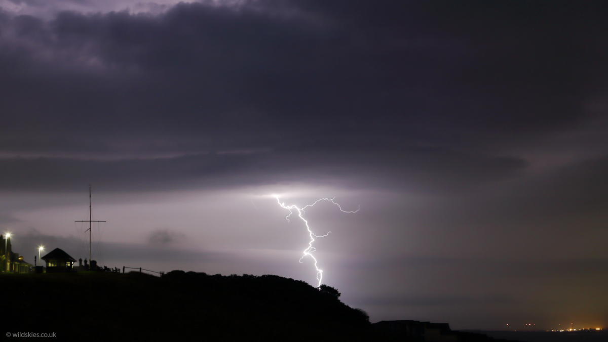
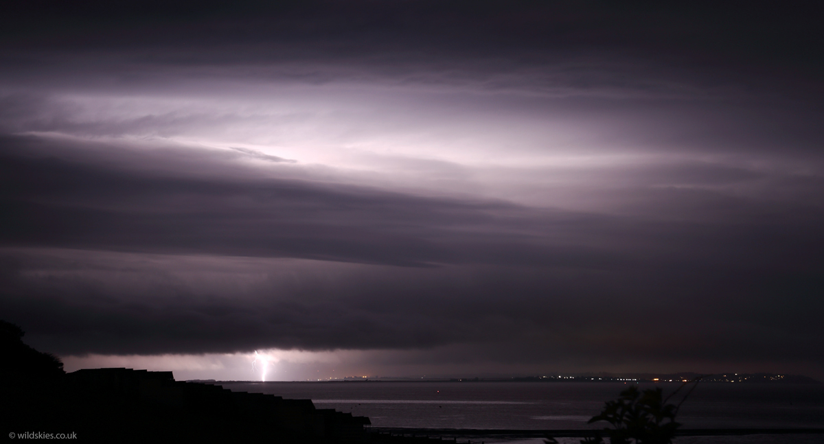
A large shelf cloud rapidly formed on the eastern side of the storm as it surged towards my location. Lightning can be seen striking a wind turbine on the Isle of Sheppey:
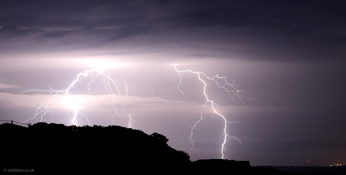
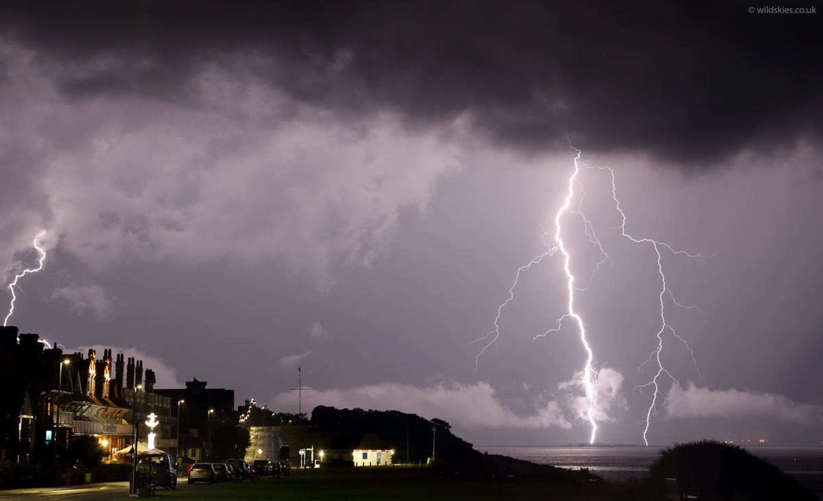
As the shelf passed overhead I got a much closer look at the brilliant-white CGs raining down - they were quite blinding:
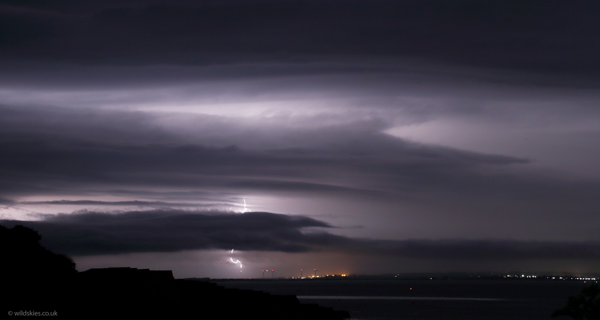
Finally the torrential rain arrived, but I was lucky to get this final CG before it moved out to sea. All in all a worthwhile chase!