Day 2: Colby, KS to Colby, KS
This was an enhanced risk day from the SPC (Storm Prediction Center) with a chance of tornadoes in Nebraska. Our first target was near McCook, NE for lunch whilst we waited to see what developed. It seems we were in the right place as pretty much every storm chaser was in town!
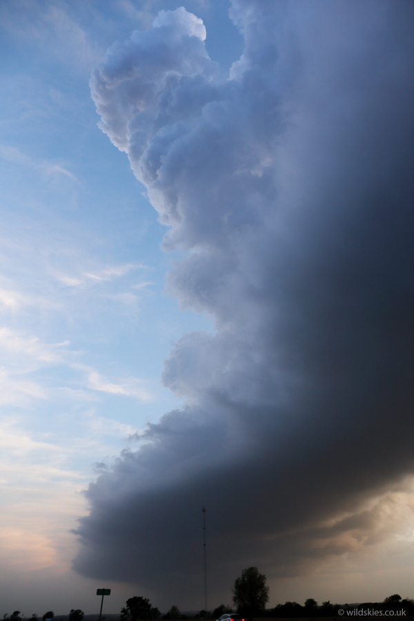
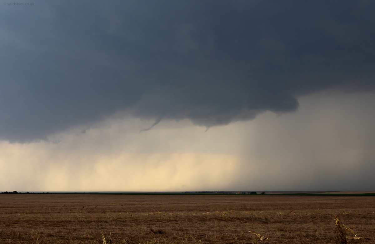
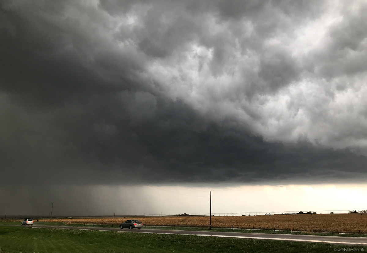
The first storms fired not long after we had lunch. This one looked promising, on the SW of town, so we sat tight and watched it approach slowly:

This storm looked increasingly good on radar, with signs of rotation, so we drove to get a closer look. When we got closer, rapid rotation was clearly visible with several shear funnels forming and dissipating:
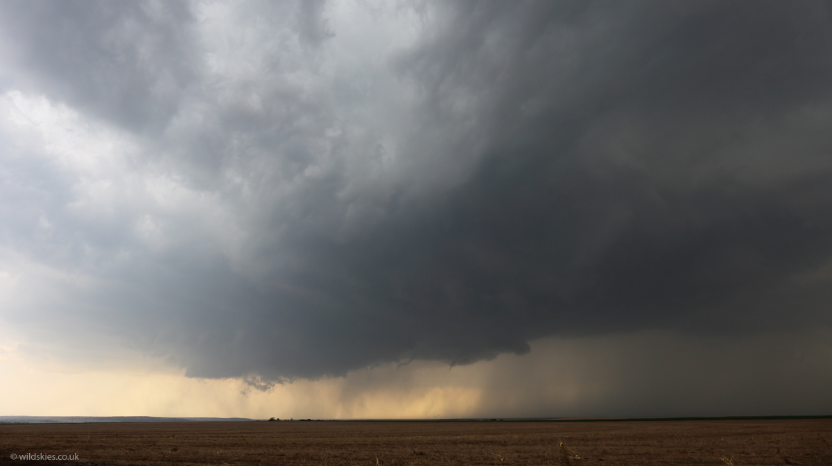
The rotating part of the storm was aiming right for us. There were a couple of brief 'spin-ups' underneath, but we let it go right over our location. Just after the following photo we got hit by a developing tornado that went right over our cars! It was pretty intense for a few seconds as we got blasted with debris and tumbleweed from the field across the road. Winds were probably 80mph or so:
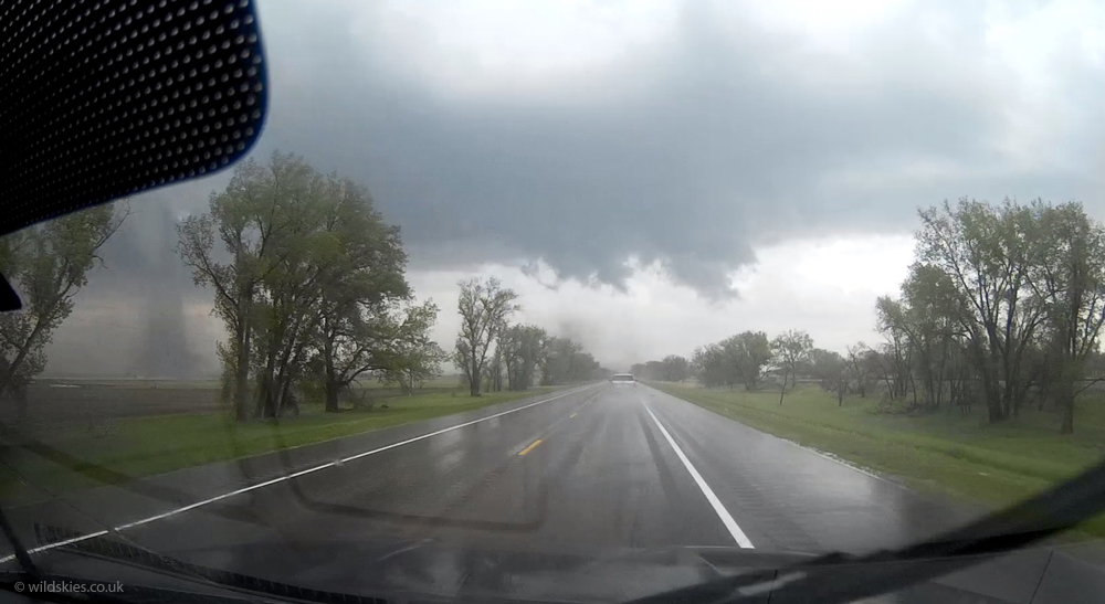
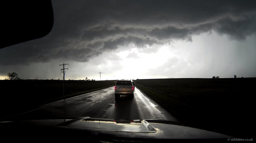
As it had now got ahead of us we had to punch through the core of the storm to get back on track. We encountered some golfball-sized hail enroute, giving the cars a few dents. As we emerged the other side a second tornado formed just to our NE. Here is a grab from my dashcam, showing it lifting dust to the left:
We pulled over just in time to see it as its strongest. An impressive, white cone tornado with tons of dust spinning round its base. There was so much traffic I couldn't cross the road to get under the powerlines!:
It roped out and disappated after around 5-10 minutes so we carried on, trying to keep up with the storm, which was moving fairly fast to the NE of town. McCook had its tornado sirens going when we drove through but the town, thankfully, escaped the tornado. As we were driving along, tornado number three touched down in a field to our north. We didn't have time to stop for photos but here's a screen grab of it just to the left of us:
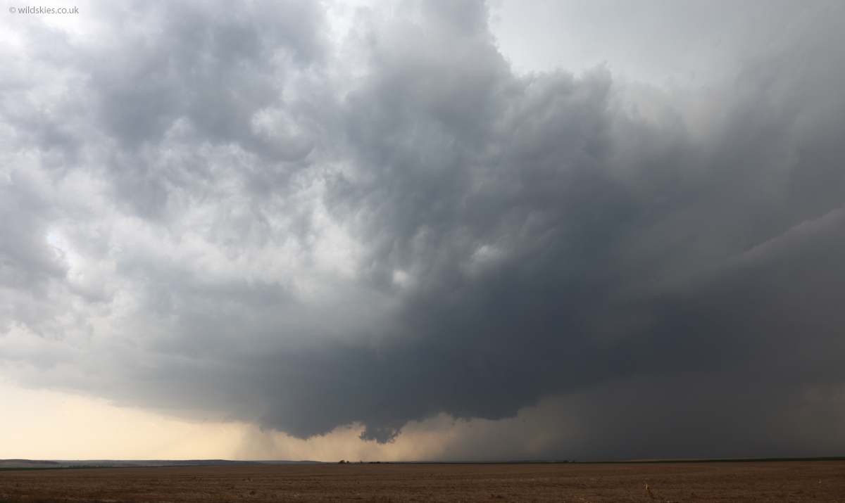
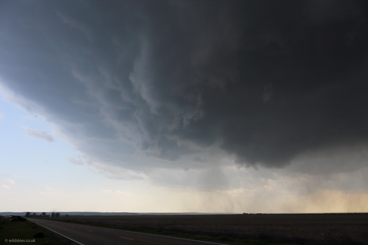
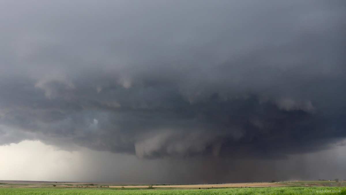
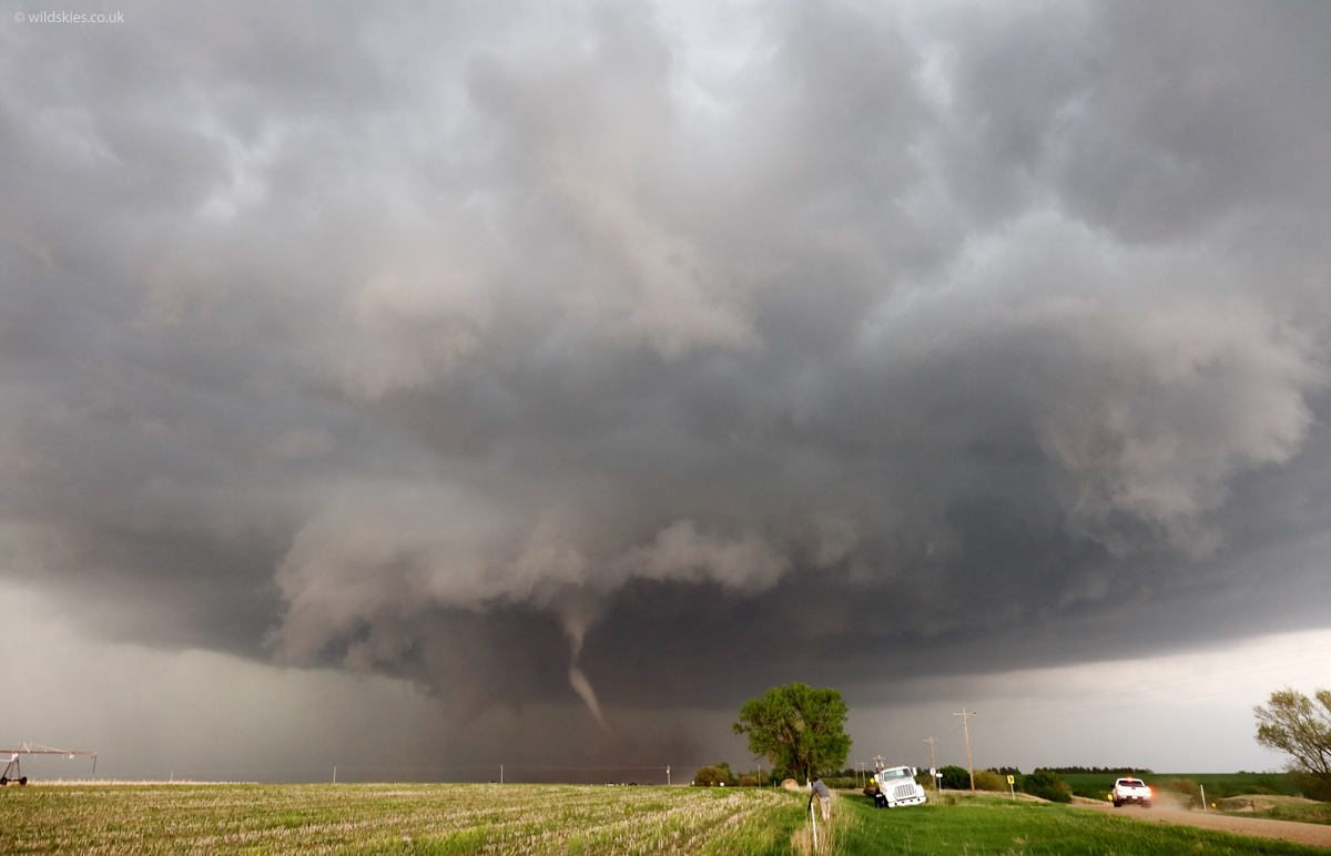
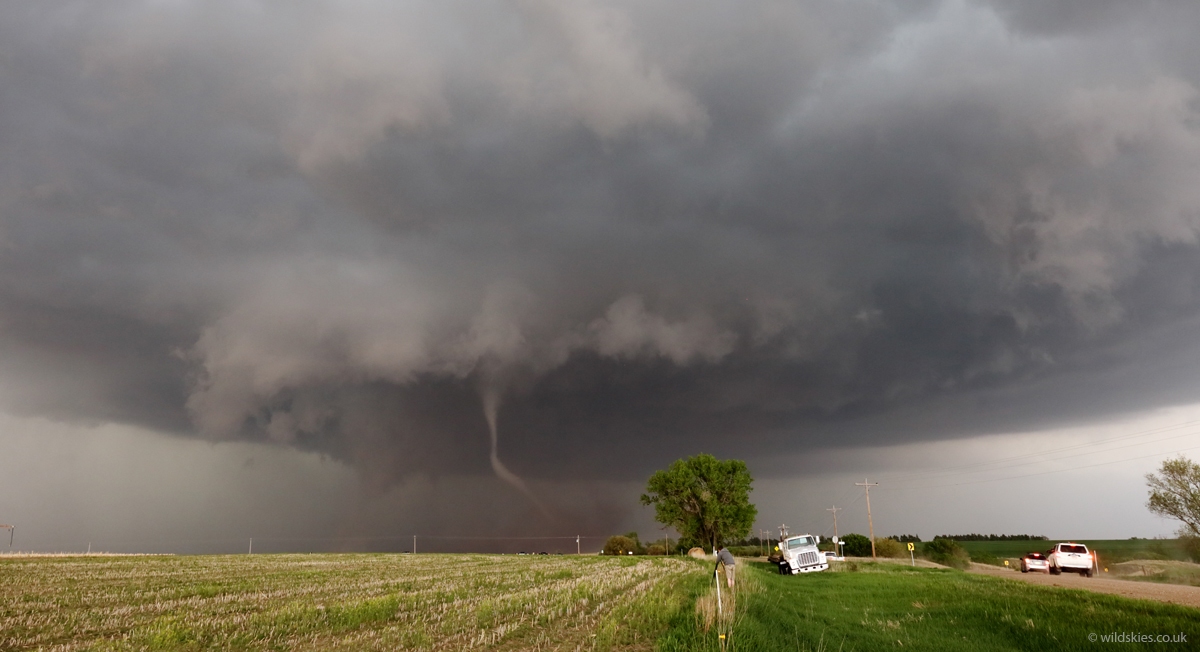
We had to drive on to dirt roads to keep up with the storm. It looked increasingly structured as we got closer and looked like it would produce a fourth tornado any minute. Here is the wall cloud getting ready again:
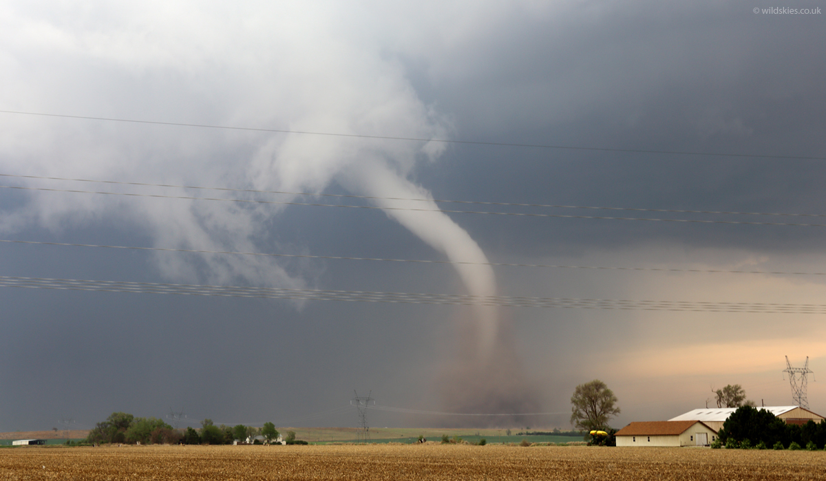
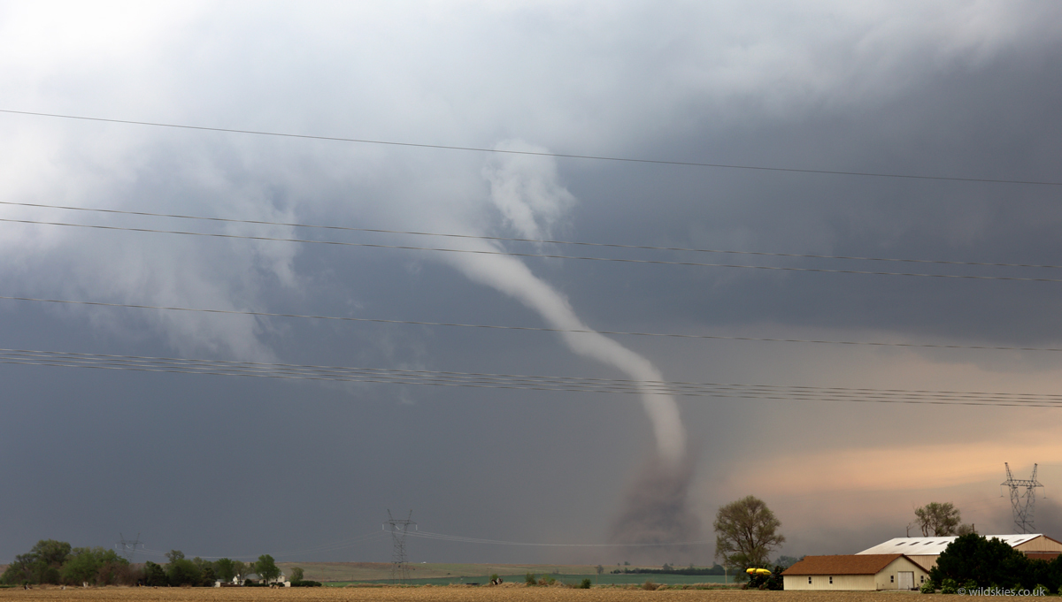
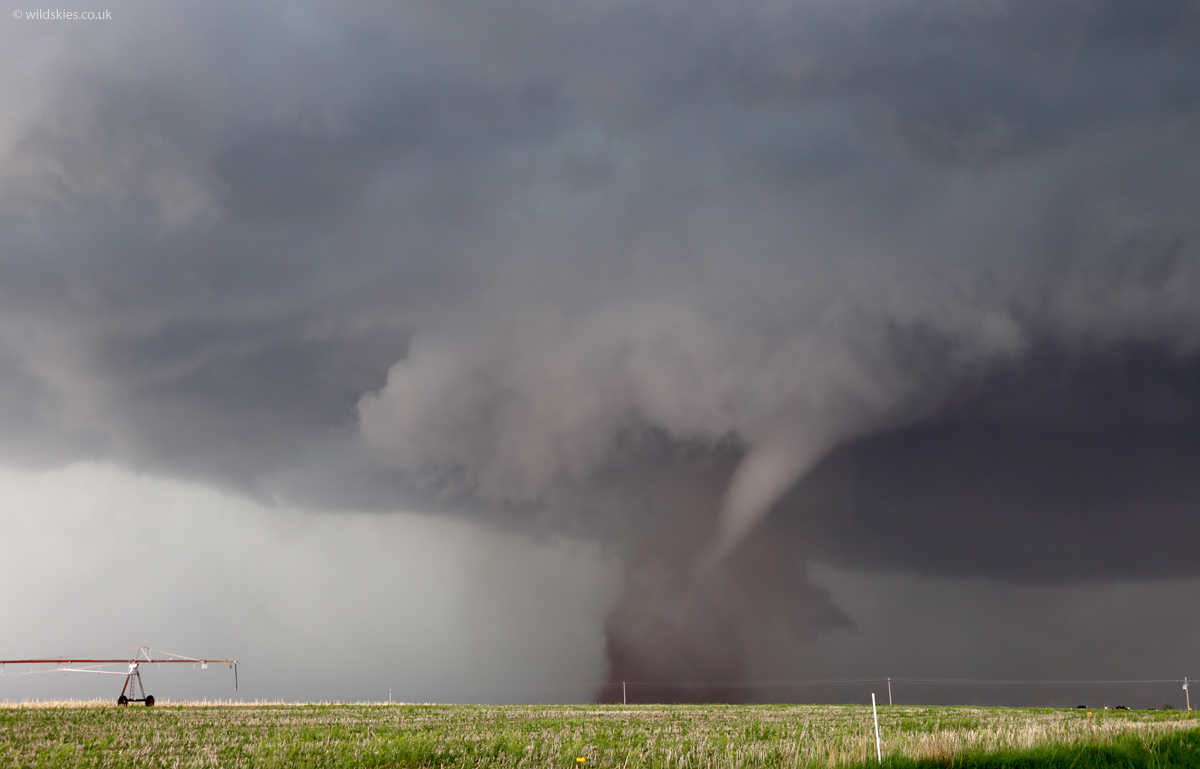
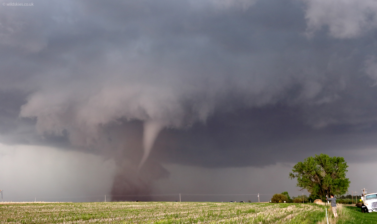
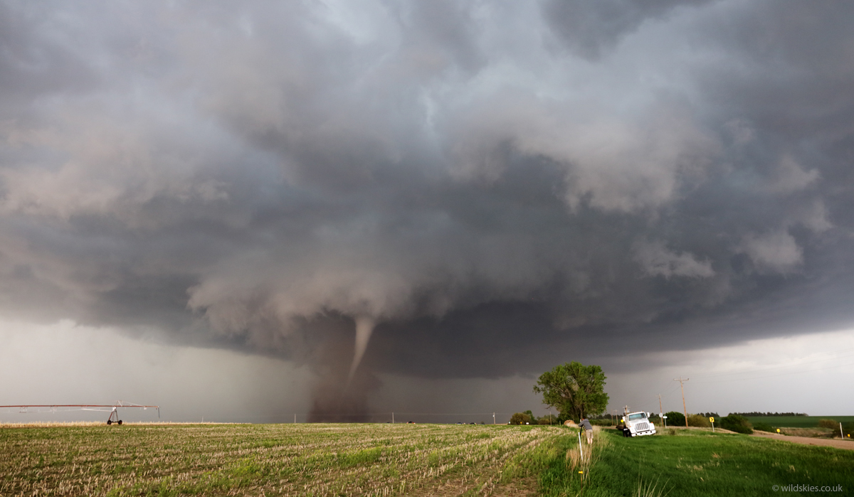
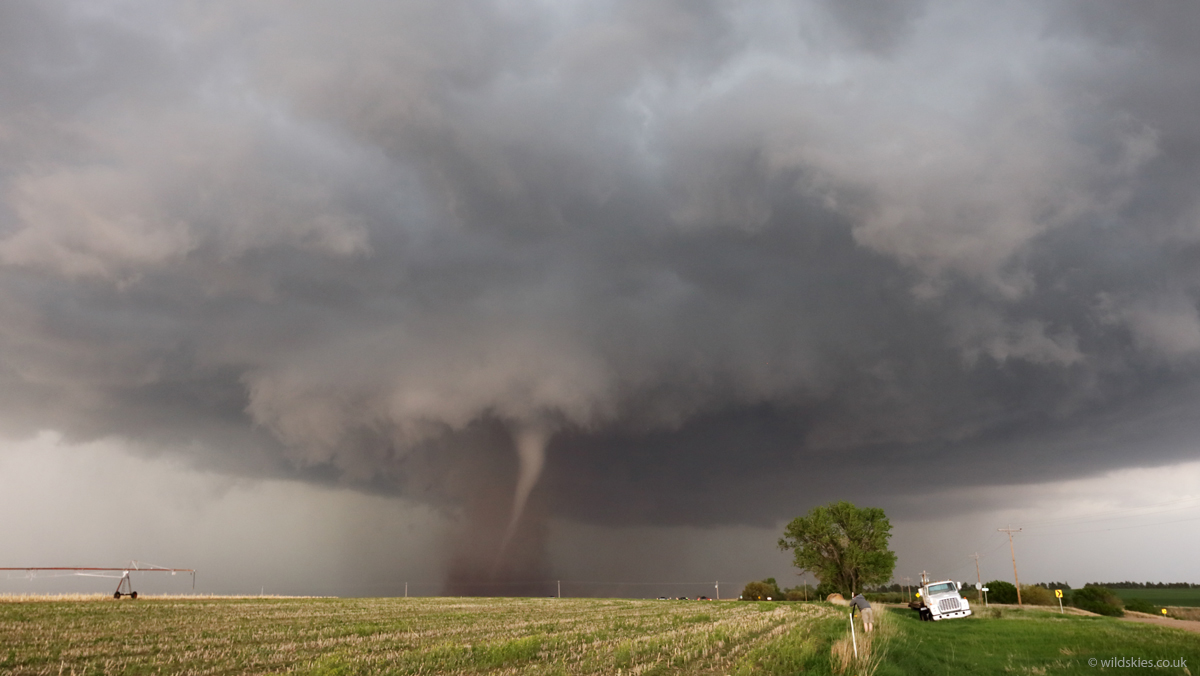
Then, the most photogenic tornado, number 4, touched down not far from the town of Farnham, NE. The whole mesocyclone could be seen rotating above us as the tornado ripped through fields for around 5 minutes:
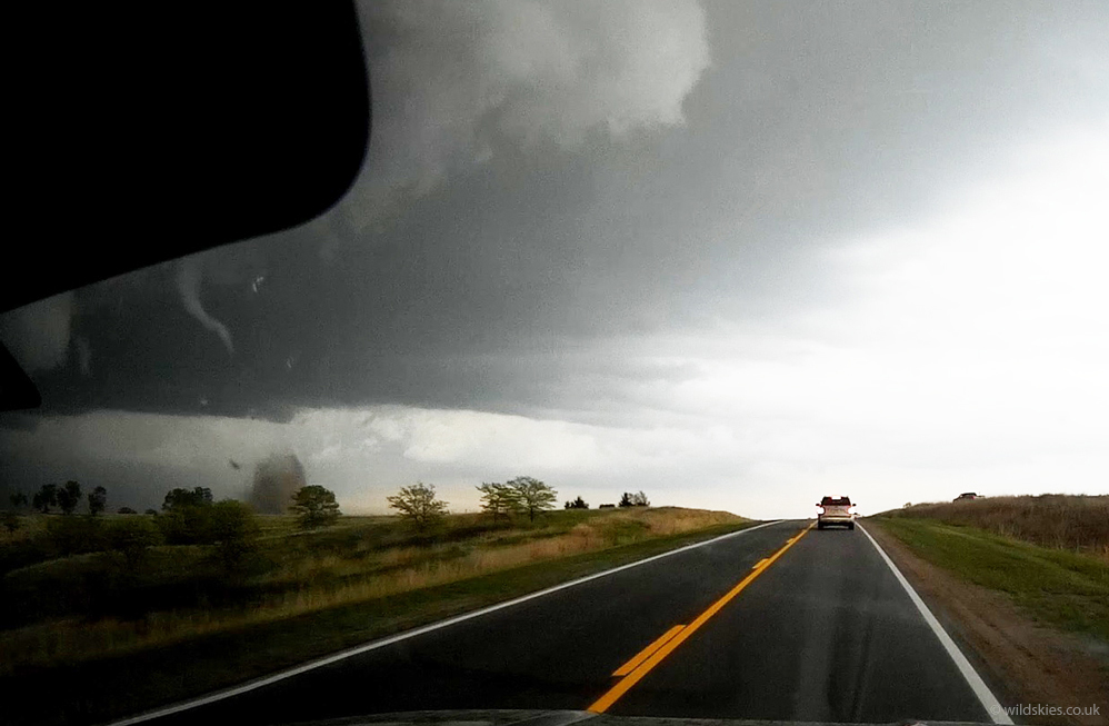
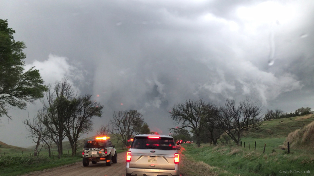
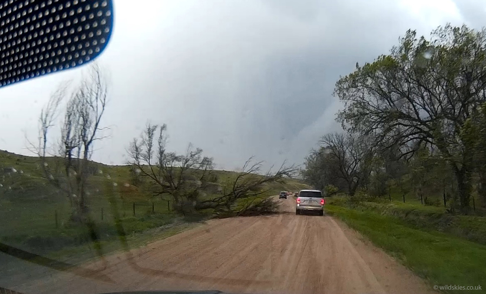
The storm quickly wrapped up again however, forming a larger, wedge tornado just a few minutes later (number 5). We stopped on the road to let it pass around 1/4 mile in front of us. As we moved forwards afterwards, we had to navigate round felled trees, and unfortunately the tornado ripped powerpoles off at the base and hit a house, so the road was closed and we could no longer follow the storm and the chase was over. The tornado was rated an EF3. The following shots are screen grabs from my dashcam as it passed in front of us and as we were driving under a new mesocyclone after we had to turn back due to the road closure:
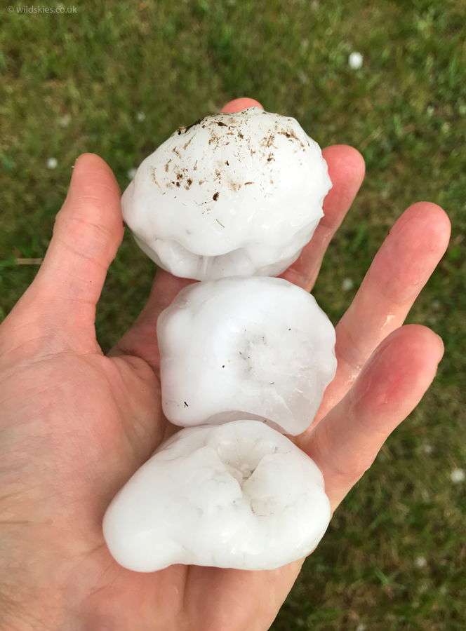
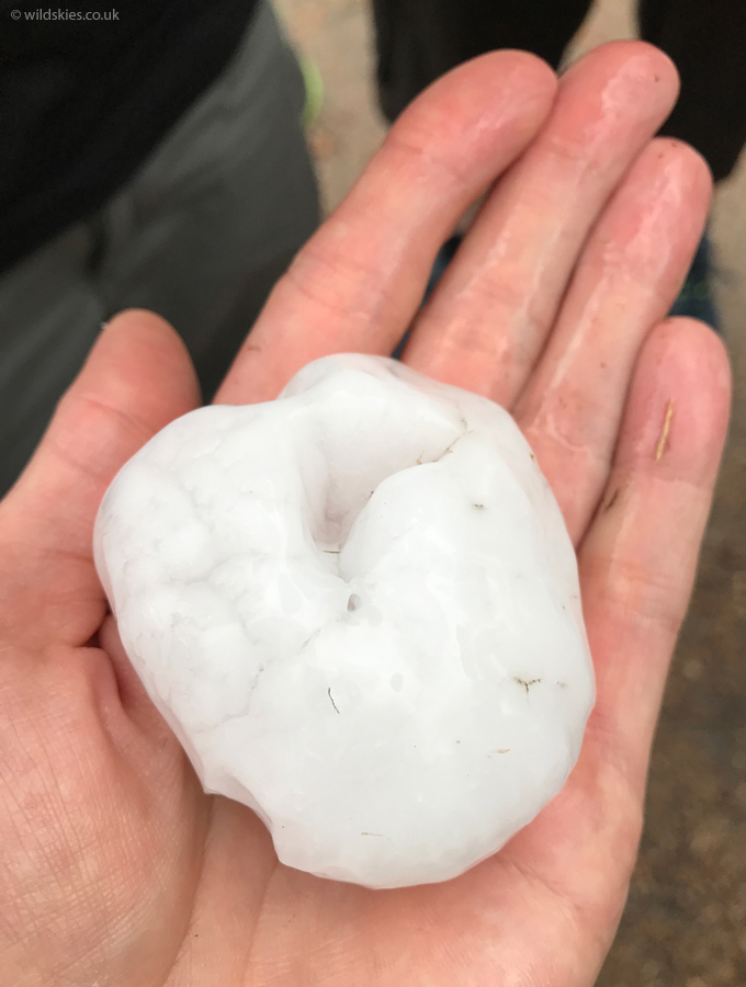
We pulled over at the entrance to a farm and watched the storm move away slowly, unable to follow. The farm owners came out chatted to us about their experience of the storm; they were very firendly, as is everyone out here. We noticed some large hailstones in the grass around us and searched out some of the biggest; some were almost baseball sized:
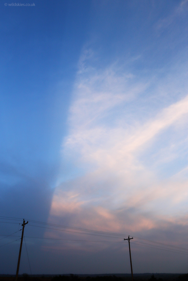
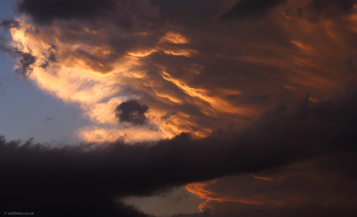
To end the day we were treated to a nice boundary that went right overhead, with towering cumulus creating some nice anticrepuscular rays. The back of the tornadic storm was also lit by the setting sun as it moved away. Overall, I think my best chase day to-date: