June 25th/26th: Thunderstorms over the English Channel
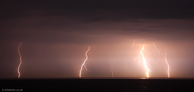
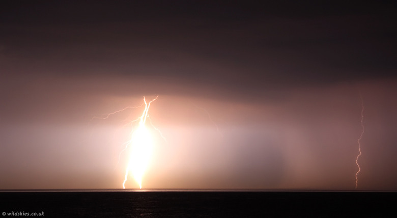
It's been nearly 3 years since we had a lightning display at night down here, so I couldn't miss the opportunity to get some shots as the remnants of a MSC over France drifted north into the English Channel and towards the south coast by around 2300 BST. On arrival at the coast, most lightning was distant and IC (Intra-Cloud), but some renewed development provided some very nice CGs (Cloud-to-Ground strokes) by about 2305 BST. As you can see from the first shot, exposure was tricky due to the varying intensity of the lightning. These bolts occurred pretty much simultaneously:
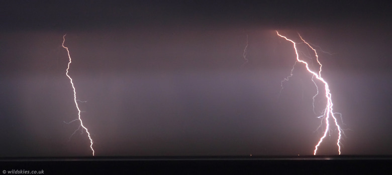
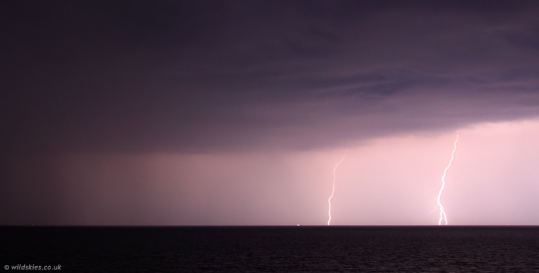
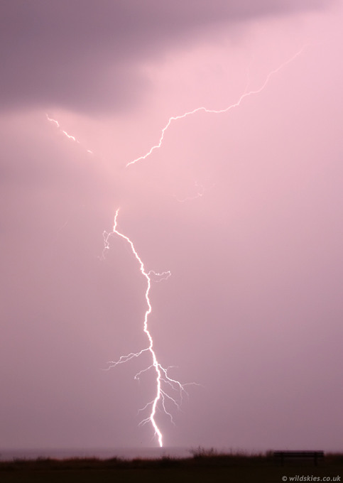
I zoomed in to the area of most activity to get some closer shots. Focus isn't perfect unfortunately:
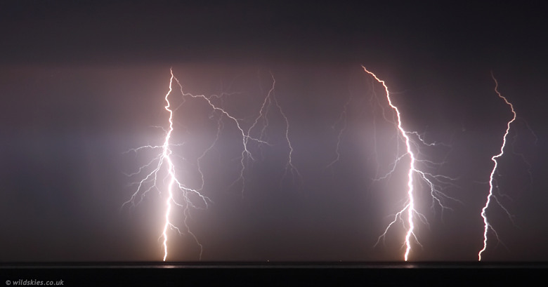
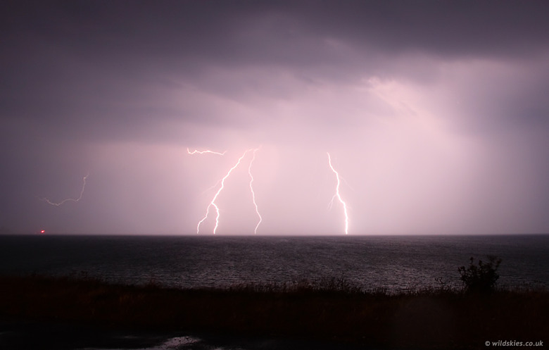
There were some really nice, multi-branched strikes to the sea:
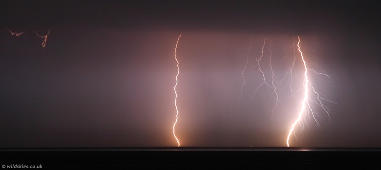
Here you can see a heavy rain core to the right of the image. Lightning was over-exposed to the left:
Here you can see the advancing gust front at the leading edge of the rain area. Winds were from the NE at this point, flowing into the storm:
A few minutes later the wind switched 180° to become a SSW'erly as the gust front approched. You can see the wind creating waves on the sea surface:
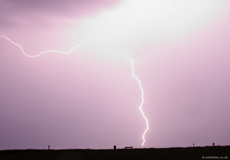
To try and get away from the now heavy rain and strong winds, I drove to a new vantage point a few miles west. The rain soon caught up with me however, so I had to resort to hand-holding from inside the shelter of the car. Because it was pitch black outside, this method worked OK:
This was the last shot of the evening as the rain and wind began to come into the car too. Bolt hit about 2-3 miles away, again hand-held:
So over all a decent storm (by our standards), although the lightning was never more frequent than a strike every minute or so. When the storm first arrived at home, it gave 7mm of rain in less than 5 minutes, with a total of 27mm (just over an inch) by around 5 a.m.