July 28th: Distant Large Thunderstorms
Temperatures on the 28th reached higher than 27°C across large portions of the UK, and when these combined with humid air from France, several active thunderstorms developed
over inland Southern England. They were too far away for me to try and catch up to them in busy UK traffic, so I decided to head to a vantage point in the New Forest with a view to the north and northwest.
The storms were very obvious even from this distance (more than 50 miles away). The largest storms, probably a multicell, were over parts of Gloucestershire and Bath, with more forming over northern Wiltshire.
Storms viewed late afternoon looking north:
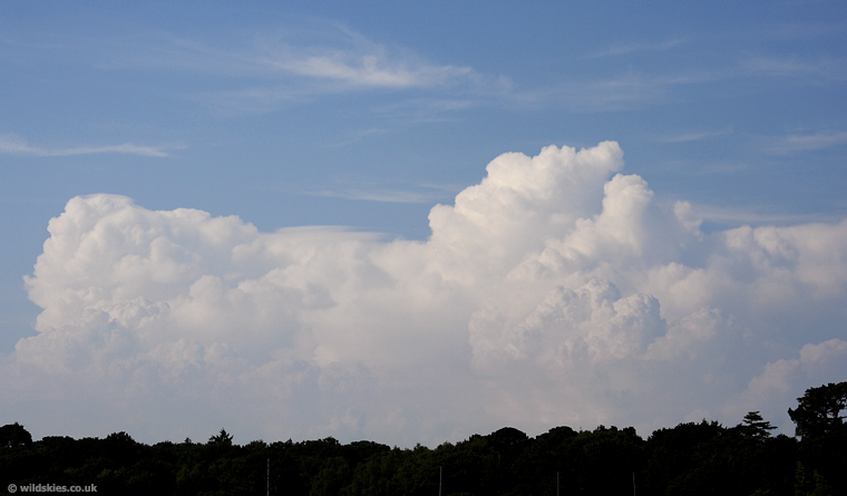
Closer view of the strong convective updraughts. I had to use a polarising filter due to the haze:

A new anvil forming on the above storm a few minutes later:

Storms continued to develop into Wales and the rest of Southern England that evening and overnight. Unfortunately many areas missed out completely. This area only had a couple of light showers.