June 23rd: New Forest Thunderstorm Deluge
Well, this has been one of the most ineteresting weather days this year in the area, with rather more rain that expected!
The forecast was for heavy, thundery showers, so I headed out early afternoon, by which time some rapid developments were taking place, with the first thunder being heard around 3 p.m.
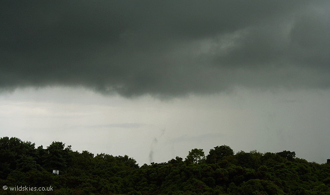
The picture below shows just how moist the atmosphere was at the time with clouds from nearly ground-level, all the way up to the tropopause.
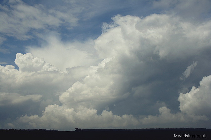
This was the source of the thunder, the first storm of the day, approaching slowly from the west near Brockenhurst, Hampshire.
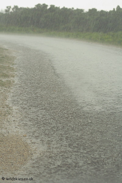
I decided to drive into the storm because it was so slow moving. About 1 mile west I hit a torrent of water, making driving conditions very poor.
I stopped at a vantage point and took a shot of the rain through the windscreen. As you can see, some local flooding was already occurring.
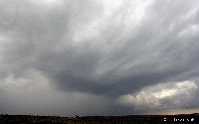
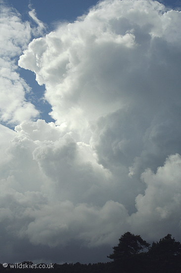
As that storm cleared, visibility improved enough to see another storm directly behind it, ready to give another deluge.
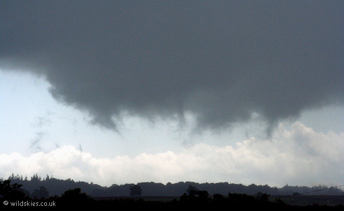
The rain core was visually impressive as it seemed to devour the landscape towards my location. Some very low scud can be seen to the left of the storm.
A close-up of the scud, rapidly forming and being sucked into the cloud above. Cloudbase was perhaps only 200-300ft here.
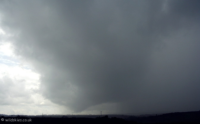
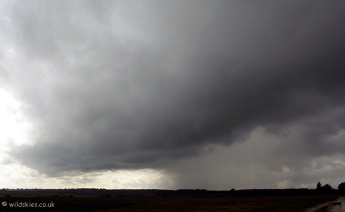
I waited for the heaviest rain to clear, then headed south a couple of miles. The storm looked evil as I followed it's gust front, giving a good 'whale's mouth' effect.
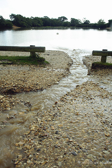
Storm number three passed over whilst driving, flooding large parts of the forest. Here, a carpark had much of it's surfaced washed out into the nearby boating lake.
Looking north-east at storm 3, the last of the storms. To the west was clear blue skies.
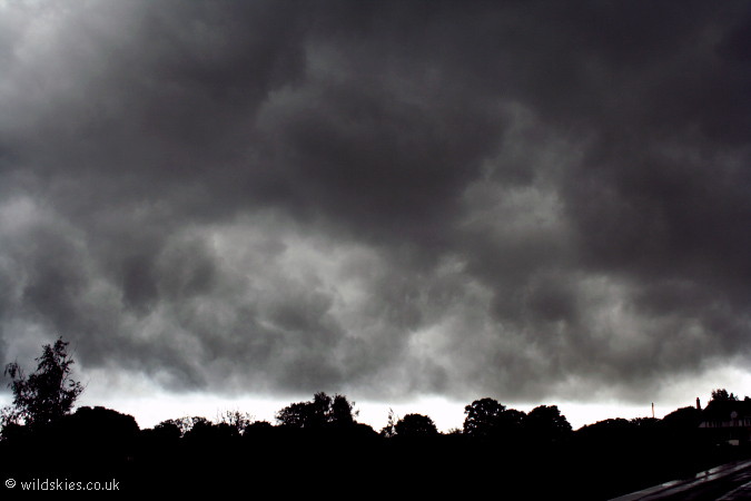
There were some very rapid scud formation on the back edge of this storm. Here you can see scud forming at treetop level and at one point a full connection
with the treetops was made. I couldn't see any rotation so it was nothing other than scud.
I followed the storms east to try and get a view of the departing cumulonimbus. Here is a newly-forming anvil just east of Beaulieu.
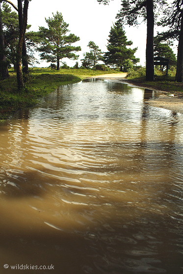
The forest was flooded quite deep in places, not unusual but the worst I've seen since November 2002.
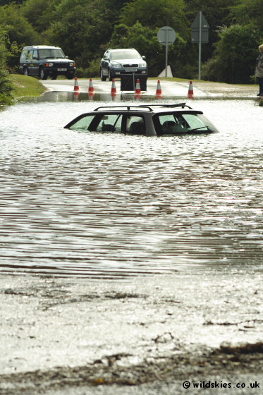
Driving back through Brockenhurst, I came across this unfortunate driver who obviously missed the
water-depth indicator and 'road liable to flooding' signs. This is a sign of a large amount of rain (50+mm) judging by past events and amounts.
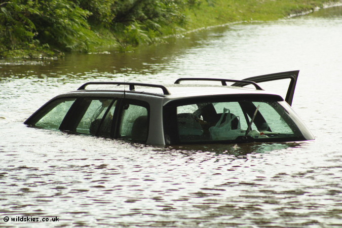
Another view of the car. Two hours earlier it was sunny and dry, an hour after this picture the road was re-opened, such is the
nature of flash floods. One of my pictures of the car featured in the local 'Southern Daily Echo' on the front page.
So, an eventful day as far as rainfall goes, probably a once in 5 year event for the area. Not much thunder occurred, mainly in the first storm.