August 7th: 2 Funnel Clouds, nr Burley, Hampshire
The forecast for this day was looking good for the chance of funnels/spouts, due to a zone of convergence along the south coast.
A breeze from the NW would converge with a sea breeze from the south. Coupled with favourble conditions for thunderstorms, I decided to head for the sea breeze 'front'
as it formed in the early afternoon over the southern part of the New Forest. I arrived around 1345 BST to find storms rapidly forming overhead. I'd arrived just in time.
Here, a storm to my east is already producing the first cracks of thunder at around 1350:
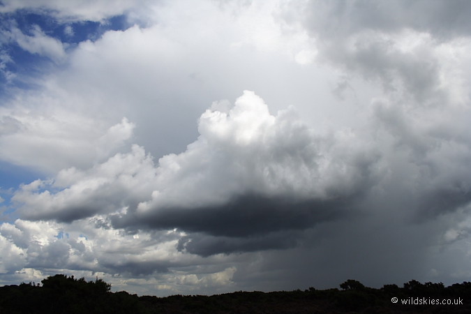
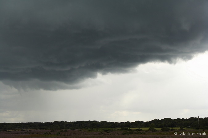
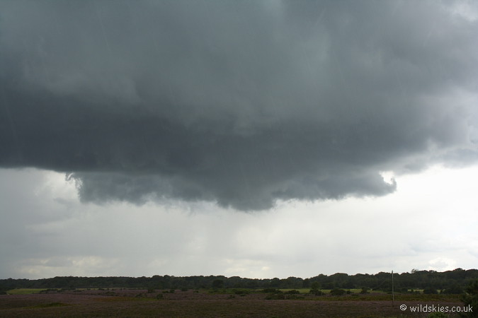
Several storms were lining up all along the sea breeze boundary. To my NW, about 0.5 miles distant, a very ominous, clean-looking updraught base was forming beneath a developing storm:
I watched it closely for several minutes and noticed several areas of tight rotation in the rising scud. Things were looking good as the first of several cloud-to-ground (CG) lightning strikes
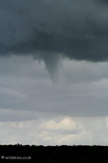
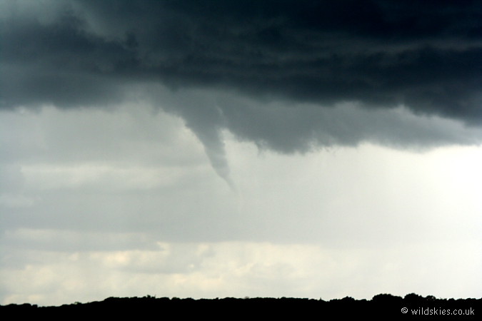
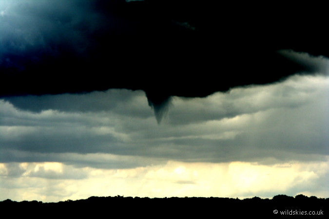
occurred. Then, suddenly a lowering. I didn't think anything of it at first, but I could see clear rotation, and a funnel was quickly forming:
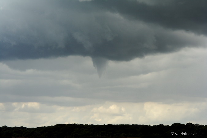
It didn't descend very far, but was a nice 'stumpy' shape. Here's a slightly closer view:
That funnel eventually dissipated after about 4 minutes. The cloudbase still looked good however, as thunder became more frequent and lots of rotation was going on:
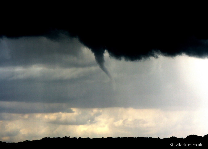
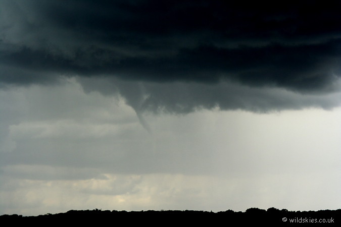
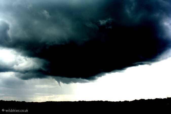
Sure enough, about 5 mnutes after the first funnel faded, another began to lower from the same position. This one was much longer, but narrower:
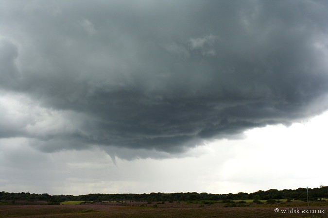
A view of the whole storm base with the funnel clearly visible to the left of the image:
Here's a closer image as it began to twist itself apart:
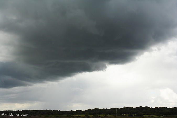
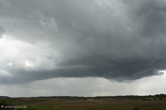
The storm continued, but eventually became dominated by outflow winds and heavy rain/hail. It did appear to try and develop a wall cloud just after the second funnel retreated, though I can't be sure if it was one:
The view of the storm by approx 1420, as it became just another heavy thunderstorm. It caused quite a bit of flooding as it remained over the same area for over an hour:
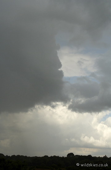
Just seconds before this image, a big CG hit in the woods to the bottom of the photo. It was most likely a positive bolt
from the anvil, as it came out of the clear air to the right of the intense updraught on the left:
I had a play with photoshop to try and bring out the funnels. Here is funnel 1:
The image of the whole storm with funnel 2 to the left:
Finally, a close-up of funnel 2, showing that it reached almost halfway to the ground at one stage!: