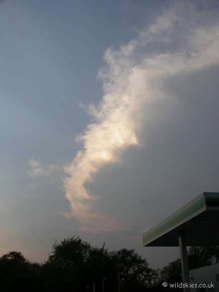
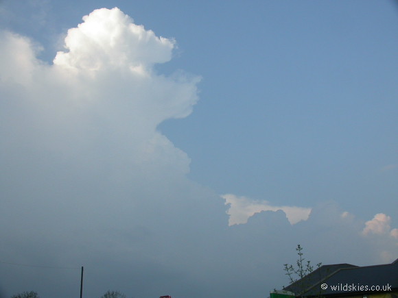
May 10th: Nr Andover, Hampshire
This large multicell storm formed to the west of London in the late evening in a 'loaded gun' environment.
The cap broke at around 4:00p.m and by the time I intercepted the storm at around 5:30 p.m it had grown into a beast. It was the only cloud in the sky above England at the time and had no competition
to hinder continued development. The only decent shots I obtained were just outside Andover, Hampshire, looking north towards the large anvil shields.
The storm was creating large amounts of rain and caused some local flooding. There was plenty of lightning too, most of which was CC (cloud to cloud).
The most noticeble feature however was the large (by UK standards) hail just behind the gust front, measuring about 20-25mm in diameter. It certainly made a noise as it pelted the car,
but luckily I managed to take shelter of sorts under a tree.
The storm continued it's journey westwards to affect parts of Gloucestershire and Somerset until well after dark.